
What Is El Niño? Here’s What It Means for Weather, Water, and Global Economy
El Niño looks to reach an intensity unprecedented in recorded history.
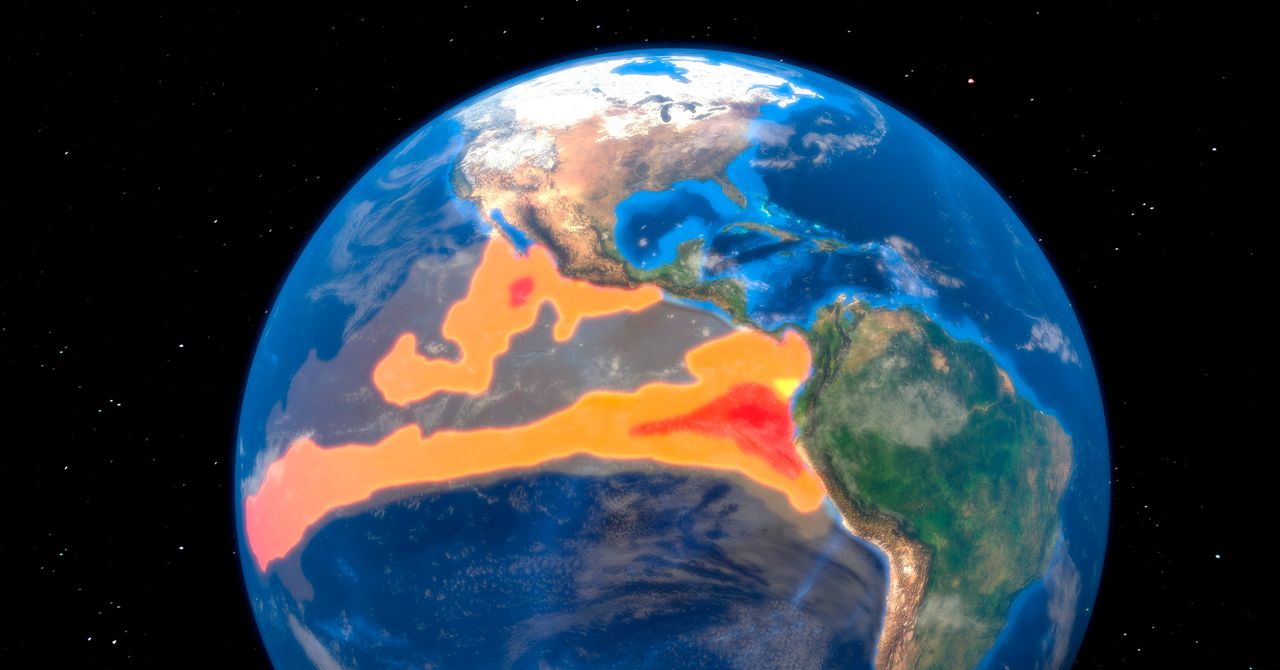
Characterized by warmer-than-normal sea surface temperatures in the equatorial Pacific, El Niño occurs every few years. Meteorological agencies and researchers around the world are on high alert because when the heat stored in the ocean is released into the atmosphere, it triggers a chain reaction that affects rainfall, temperatures, and even hurricane activity around the world.
This year’s El Niño has gained strength at an exceptional speed, and it will wreak havoc on everything from fisheries to ski seasons. Not all impacts are bad—the parched Southwest, for example, is likely to see more winter precipitation—but anticipating them is the key to being prepared.
What exactly is happening now, and what might happen in the coming months? Read on to understand what El Niño is, why this one might be a super El Niño, and where its impacts will be most acutely felt.
What Is El Niño?
Declaring an El Niño requires meeting a certain threshold of oceanic heat in the Pacific—specifically, a region known as Niño 3.4. It’s an area that sits between Niño 3 and Niño 4 if you want to geek out even more. In plain language, it’s a region in the eastern-central tropical Pacific.
The US National Oceanic and Atmospheric Administration uses the three-month average sea surface temperature of the region to determine if an El Niño is in effect. If the ocean is 0.5 degrees Celsius (0.9 degrees Fahrenheit) above normal for three overlapping three-month periods, it’s officially an El Niño.
Other weather agencies do things a little differently. Japan’s Meteorological Agency monitors a slightly different region using its own criteria, while the Australian Bureau of Meteorology’s threshold has an atmospheric component as well.
In addition to warmer oceans, the trade winds that blow from east to west also weaken. That allows seawater to pile up on the eastern side of the Pacific. In 1997 and 2015—when El Niño events were among the strongest on record—sea levels rose more than 18 centimeters (7 inches) above average.
All this increases the odds of shifts in weather around the world. There’s the aforementioned increase in rainfall in the Southwest as well as a corresponding decrease in Pacific Northwest precipitation. Atlantic hurricane season tends to be milder as well, with fewer storms.
Indonesia sees an increased risk of drought, as do parts of southern Africa. El Niño also tends to raise the odds of winter warmth in Japan and parts of Australia and Brazil. (We can only speak of probabilities, because El Niño is not the only phenomenon affecting the weather on a given day or in a given season, but the phenomenon tilts the odds.
What Is a Super El Niño?
“Super El Niño” isn’t an official term any meteorological agency uses, but scientists generally use it to define any event where temperatures rise by at least 2 degrees Celsius above average. While there’s no standardized definition, four particular El Niños are ones that check the super box: 1982–83, 1997–98, 2015–16, and 2023–24.
When the Super El Niño occurred in 1982–83, the Colorado River Basin in the US was hit by record-breaking heavy snowfall. Combined with high spring temperatures and rainfall, the river’s flow exceeded 1.5 times the average. Reservoirs upstream filled to capacity one after another, forcing emergency releases, and Lake Mead also reached near-capacity, causing water to overflow from the Hoover Dam spillway for the first time in about 40 years. As a result, the basin suffered significant flood damage. In other words, the impacts of El Niño that may be “good” can still lead to bad outcomes.
In 1997–98, Indonesia was hit by the worst drought in the past half-century, while the 2023-24 super El Niño contributed to the worst drought in over 100 years for southern Africa. Conditions were so extreme that approximately 61 million people needed humanitarian aid.
How Is This El Niño Shaping Up?
There is a greater than 90 percent probability of this El Niño becoming “very strong” this fall and winter, according to NOAA.
Modeling by Berkeley Earth shows that median temperatures for the Niño 3.4 region could reach 3.6 degrees Celsius above normal—even after accounting for the effects of long-term global warming. This would exceed the all-time high recorded during the 2015–16 El Niño by approximately 0.8 degrees Celsius. Given that the difference between the strongest and fifth-strongest El Niño events over the past 150 years was only about 0.5 degrees Celsius, this represents an exceptional level of warming.